Rp130.000.000Harga aslinya adalah: Rp130.000.000.Rp120.000.000Harga saat ini adalah: Rp120.000.000.
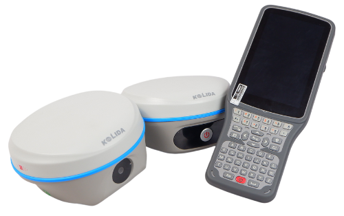
GPS KOLIDA K50
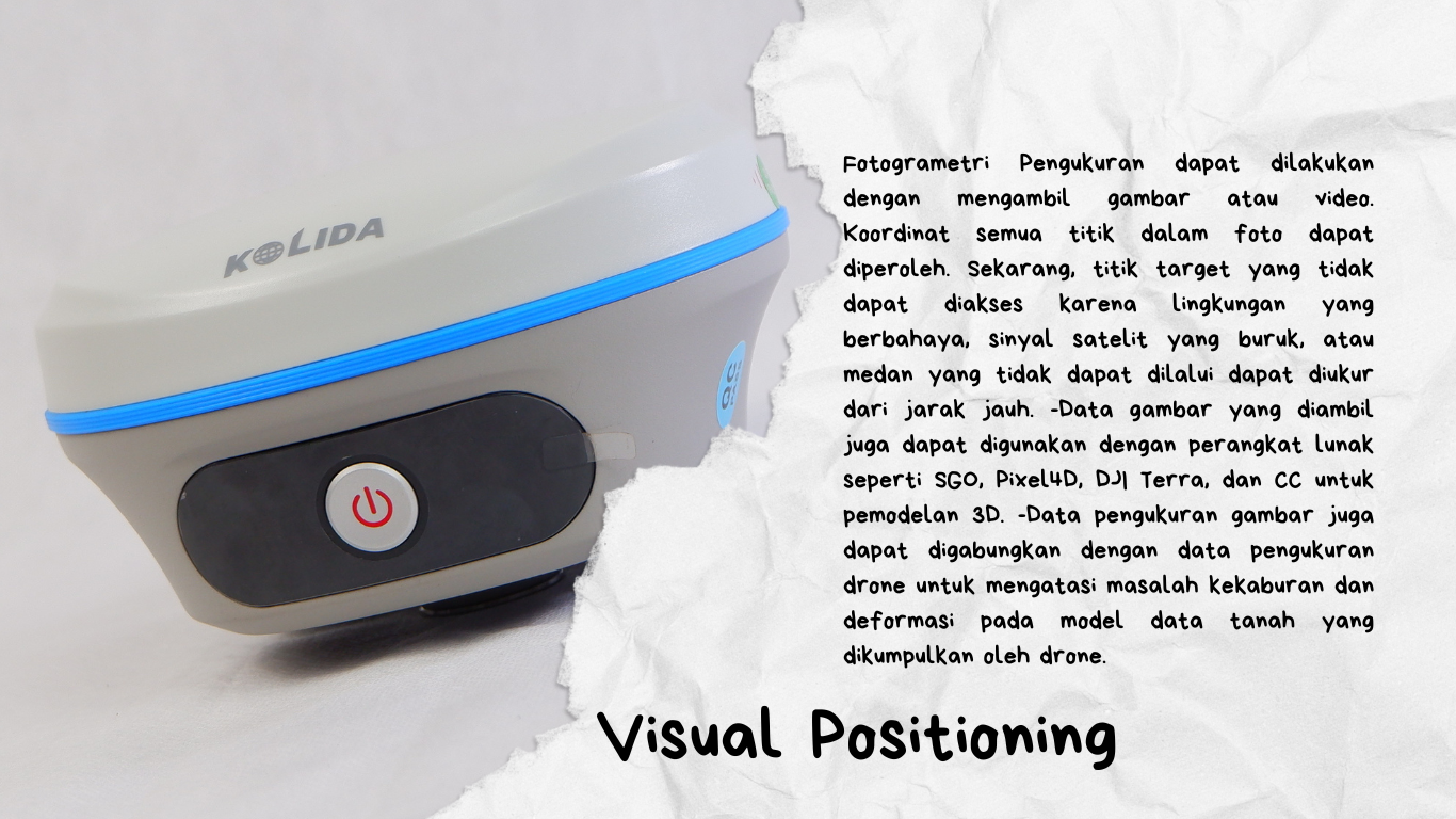
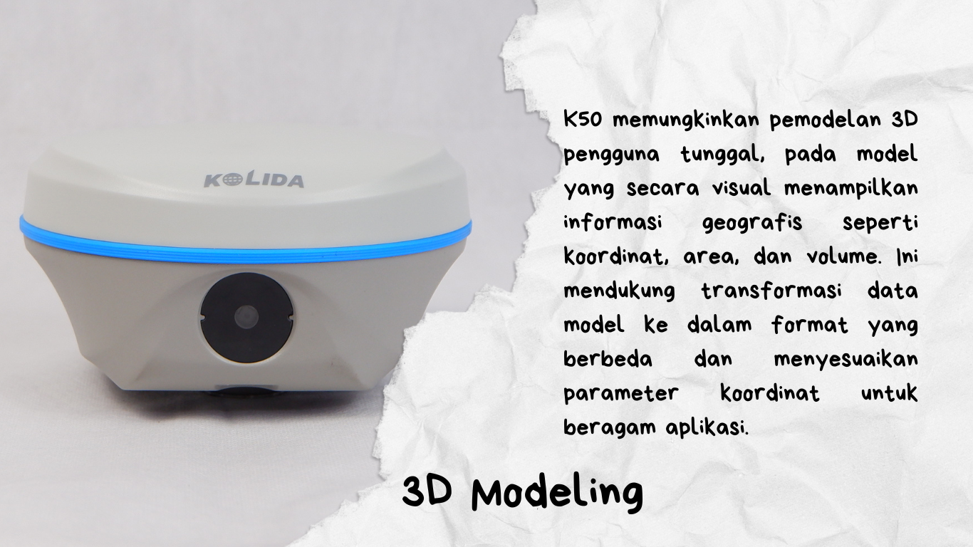
Kolida K50 dapat memproses serangkaian foto atau video, memperoleh koordinat untuk ratusan titik dalam hitungan menit. Alat ini memiliki jangkauan kerja yang lebih luas dan lebih sedikit titik buta melalui pengukuran jarak jauh dengan kamera. Lokasi yang dulunya menantang, seperti ruang di bawah atap dan area dengan rintangan, sekarang mudah diukur.
Kolida K50 dapat memproses serangkaian foto atau video, memperoleh koordinat untuk ratusan titik dalam hitungan menit. Alat ini memiliki jangkauan kerja yang lebih luas dan lebih sedikit titik buta melalui pengukuran jarak jauh dengan kamera. Lokasi yang dulunya menantang, seperti ruang di bawah atap dan area dengan rintangan, sekarang mudah diukur.
Network model support: VRS, FKP, MAC, fully support NTRIP protocol
Sensors
IMU
Camera
Visual positioning camera: 8MP (can be used in AR stakeout) AR stakeout camera: 2MP
Controller software can display electronic
Electronic bubble
Thermometer
bubble, checking leveling status of the carbon pole in real-time Built-in thermometer sensor, adopting intelligent temperature control technology, monitoring and adjusting the receiver temperature
User Interaction
Operating system
Buttons
Indicators
Singlebutton
Web interaction
Satellites, data and power indicators With access to Web connection, users can monitor the receiver UI via WiFi or USB status and change the configurations
Provides secondary development package, and opens the OpenSICobservation data format and interaction interface definition
Cloud service
The powerful cloud platform provides online services like remote management, firmware updates, online registers, etc
Package :
Base & Rover K50
1 Unit Radio Eksternal
1 Unit Antena Eksternal
1 Unit Pole Ekstention
1unit Controller
1pcs Pole Mini
1unit Tribrach
1unit Stik Pole Carbon
2unit Tripod
Mencari alat survey?
Kunjungi Darwis Internasional Survey kami menyediakan berbagai alat survey yang berkualitas untuk para surveyor, kontraktor, dan berbagai industri yang membutuhkan akurasi tinggi dalam pengukuran tanah. Tunggu apa lagi ayoo dapatkan sekarang juga alat idaman kalian 🙂
Note :
Mohon tanya ketersediaan alatterlebih dahulu sebelum membeli.
Sertakan video unboxing dan berli ulasan untuk klaim garansi.
Apabila tidak terdapat video unboxing dan ulasan, maka garansi hangus.
Alat selalu kami cek terlebih dahulu sebelum dikirim.
Berat
50 kg
Ulasan
Belum ada ulasan.
Jadilah yang pertama memberikan ulasan “GPS RTK Kolida K50 See Better Work Better”Cancel Reply


Ulasan
Belum ada ulasan.